Watch Price
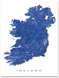
Wild Atlantic Way Pocket Map: The perfect way to explore Ireland’s west coast
Explore new places with handy pocket maps from Collins.
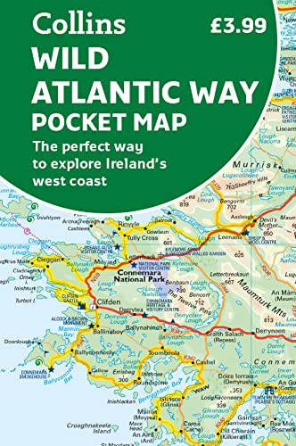
Handy full-colour map of Ireland’s Wild Atlantic Way with a high level of detail. Clear mapping of the full 2500 km (over 1500 miles) route, showing the road network and places of interest.
Clear, detailed Collins road mapping is presented in a handy format ideal for the pocket or handbag. It is excellent value and very detailed for its size, covering the whole of the Wild Atlantic Way.
Ideal for tourists, locals, hikers and adventurers. Places of interest marked, including famous film locations.
This map includes:
• Clear mapping at a scale of 8.7 miles to 1 inch
• National Tourist Routes showing best routes through the most scenic areas
• Places of interest include film locations such as Star Wars
• Tourist and signature locations clearly marked
• Suggested itineraries
• Detailed place names index
• Ideal companion to a sat-nav – it enables route planning and route sense-checking
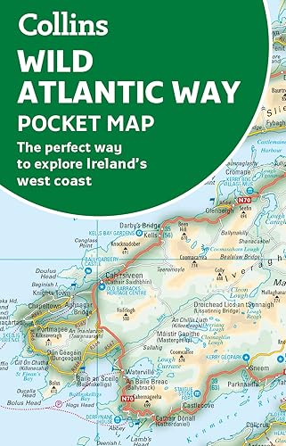
Product details
Publisher : Collins; Second edition (2 Mar. 2023)
Language : English
ISBN-10 : 0008580006
ISBN-13 : 978-0008580001
Dimensions : 8.89 x 0.51 x 13.97 cm
Best Sellers Rank: 5,345 in Books (See Top 100 in Books)
13 in Routes & Ways Travel
32 in Geography References
32 in Historical Atlases & Maps
Customer reviews: 4.3
156 ratings
Amazon Price History
This is our record of Amazon price changes for Wild Atlantic Way Pocket Map: The perfect way to explore Ireland’s west coast (0008580006) since we began monitoring it.
| Price Type | Lowest Ever | Highest Ever | Current + | Average |
|---|---|---|---|---|
| Amazon | (Jun 15, 2026) | (Jun 15, 2026) | 0,00 € (Jun 15, 2026) |
0,00 €
Amazon Price
Jun 15, 2026 04:47 PM
Your Amazon Price Watches
We'll notify you when the price drops to your desired price.
Watch Price


![The Wild Atlantic Way and Western Ireland: 6 Cycle Tours Along Ireland's West Coast [Lingua Inglese]](https://m.media-amazon.com/images/I/81ko1RIoy8L._SL500_.jpg)
The Wild Atlantic Way and Western Ireland: 6 Cycle Tours Along Ireland's West Coast [Lingua Inglese]
Watch Price

Watch Price

Watch Price

Watch Price
Watch Price


Watch Price


