Watch Price
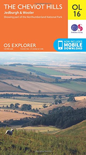
The Cheviot Hills Map | Jedburgh & Wooler | Ordnance Survey | OS Explorer Map OL16 | England | Walks | Hiking | Maps | Adventure
Discover the wild frontier hills of the Cheviots, straddling the border of England and Scotland, and charming towns with bloody histories such as Jedburgh and Wooler, the ‘gateway to the Cheviots’. Dramatic waterfalls, wild Cheviot goats and steep valleys carved by burns – it’s all waiting for you in this magnificent part of the Northumberland National Park, an International Dark Sky Reserve.
Climb The Cheviot, the highest point in the Northumberland National Park at 815 metres, for panoramic views as far as Edinburgh
Explore the Border town of Jedburgh with its action-packed history or visit Wooler, a popular base for walkers while history buffs will love nearby Chillingham Castle
Climb The Cheviot, the highest point in the Northumberland National Park at 815 metres, for panoramic views as far as Edinburgh
Explore the Border town of Jedburgh with its action-packed history or visit Wooler, a popular base for walkers while history buffs will love nearby Chillingham Castle
Product details
Publisher : Ordnance Survey; May 2015 edition (10 Jun. 2015)
Language : English
Map : 1 pages
ISBN-10 : 0319242552
ISBN-13 : 978-0319242551
Dimensions : 14 x 1.3 x 23.7 cm
Best Sellers Rank: 28,945 in Books (See Top 100 in Books)
302 in Walking, Hiking & Trekking
484 in Travel Atlases & Maps
895 in General Sports, Hobbies & Games
Customer reviews: 4.8
269 ratings
Amazon Price History
This is our record of Amazon price changes for The Cheviot Hills Map | Jedburgh & Wooler | Ordnance Survey | OS Explorer Map OL16 | England | Walks | Hiking | Maps | Adventure (0319242552) since we began monitoring it.
| Price Type | Lowest Ever | Highest Ever | Current + | Average |
|---|---|---|---|---|
| Amazon | (Jun 29, 2026) | (Jun 29, 2026) | 0,00 € (Jun 29, 2026) |
0,00 €
Amazon Price
Jun 29, 2026 01:46 PM
Your Amazon Price Watches
We'll notify you when the price drops to your desired price.
Watch Price