Watch Price
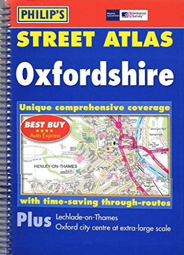
Philip's Street Atlas Oxfordshire
A brand-new edition of this successful colour atlas of Oxfordshire, giving the mostcomprehensive and detailed coverage of the region. No other atlas names every street in Oxfordshire.The mapping is prepared by the Ordnance Survey and gives the user completecoverage of all urban and rural areas. The mapping is at a standard scale of 3 inches to 1 mile (2 inches to 1 mile in the pocket edition) and is complete with postcodeboundaries.The atlas is ideally suited for both business and leisure use. There is a route-planning map and an administrative and postcode map at the front of the atlas. The main maps show every named road, street and lane clearly with through-routes highlighted. School locations are marked and emergency services, hospitals, police stations, car parks and rail and bus station locations are all featured. There is a comprehensive index of street names and postcodes that includes schools, industrial estates, hospitals, sports centres, etc, which are highlighted in colour.Main map scale: 3 inches to 1 mile
Product details
Publisher : Philip's (2 November 2005)
Language : English
Paperback : 296 pages
ISBN-10 : 0540087661
ISBN-13 : 978-0540087662
Item Weight : 740 g
Dimensions : 20 x 1.5 x 26.8 cm
Customer Reviews: 4.8
4 ratings
Publisher : Philip's (2 November 2005)
Language : English
Paperback : 296 pages
ISBN-10 : 0540087661
ISBN-13 : 978-0540087662
Item Weight : 740 g
Dimensions : 20 x 1.5 x 26.8 cm
Customer Reviews: 4.8
4 ratings
Amazon Price History
This is our record of Amazon price changes for Philip's Street Atlas Oxfordshire (0540087661) since we began monitoring it.
| Price Type | Lowest Ever | Highest Ever | Current + | Average |
|---|---|---|---|---|
| Amazon | (Jun 15, 2026) | (Jun 15, 2026) | 0,00 € (Jun 15, 2026) |
0,00 €
Amazon Price
Jun 15, 2026 03:04 AM
Your Amazon Price Watches
We'll notify you when the price drops to your desired price.
Watch Price


Watch Price


2023 Philip's Easy to Read Multiscale Road Atlas Europe: (A4 Spiral binding) (Philip's Road Atlases)
Watch Price

Watch Price

Watch Price

Watch Price


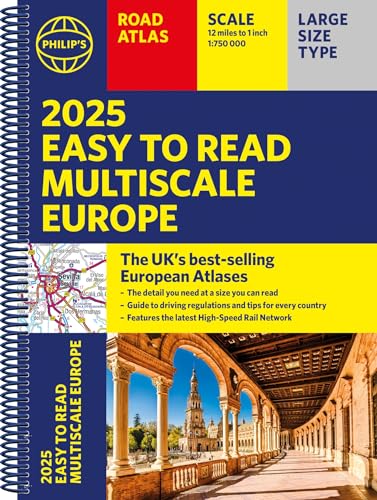
2025 Philip's Easy to Read Multiscale Road Atlas Europe: (A4 Spiral binding) (Philip's Road Atlases)
Watch Price
Watch Price

Watch Price
