Watch Price
Rick Steves France Planning Map: Including Paris City Maps
Designed for Rick Steves fans, this map highlights France's best destinations in a colorful, easy-to-use format on high-quality paper:
Cuts the Clutter: While big cities are included for navigational purposes, this map focuses on Rick’s favorite spots for travelers
Guidebook-Friendly: At a glance, all the places you read about in Rick Steves France stand out in a crisp, easy-to-read format
Durable Construction: This map is printed on tearproof paper to last over many trips
Road or Sea: Includes highways, ferry routes, bus stops, and train lines for easy route-planning
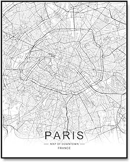
The Back's Even Better: The reverse side includes a detailed city-center map of Paris locating sights, hotels, and restaurants, plus a handy Paris Metro map
Cuts the Clutter: While big cities are included for navigational purposes, this map focuses on Rick’s favorite spots for travelers
Guidebook-Friendly: At a glance, all the places you read about in Rick Steves France stand out in a crisp, easy-to-read format
Durable Construction: This map is printed on tearproof paper to last over many trips
Road or Sea: Includes highways, ferry routes, bus stops, and train lines for easy route-planning
The Back's Even Better: The reverse side includes a detailed city-center map of Paris locating sights, hotels, and restaurants, plus a handy Paris Metro map
Product details
Publisher : Rick Steves; 2nd edition (April 9, 2024)
Language : English
Map : 2 pages
ISBN-10 : 1641715936
ISBN-13 : 978-1641715935
Item Weight : 0.917 ounces
Dimensions : 4 x 0.25 x 9 inches
Best Sellers Rank: #25,389 in Books (See Top 100 in Books)
#9 in Paris Travel Guides
#22 in General France Travel Guides
#46 in Maps (Books)
Customer Reviews: 5.0
8 ratings
Amazon Price History
This is our record of Amazon price changes for Rick Steves France Planning Map: Including Paris City Maps (1641715936) since we began monitoring it.
| Price Type | Lowest Ever | Highest Ever | Current + | Average |
|---|---|---|---|---|
| Amazon | (Jun 15, 2026) | (Jun 15, 2026) | 0,00 € (Jun 15, 2026) |
0,00 €
Amazon Price
Jun 15, 2026 04:06 AM
Your Amazon Price Watches
We'll notify you when the price drops to your desired price.
Watch Price


Watch Price


Watch Price