Watch Price
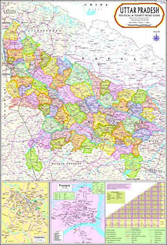
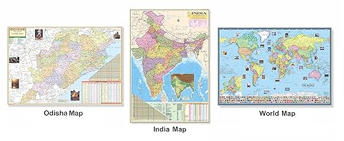
Uttar Pradesh Map | English | Laminated | 100 x 70 cm
Size : 70 x 100 cm . Language : English. Certified By Survey of India.Multicolour printing on 80 GSM map litho paper This chart is laminated on both sides with 30 micron thick plastic film making it tear & water resistant. This chart is ideal for putting up on a wall or a board. Languages Available : English Besides administrative boundaries the map also shows various Districts, Cities, Towns, Railway Network, National Highways, Major Roads, Rivers etc.
Product details
ASIN : B00PINOF3W
Publisher : Vidya Chitr Prakashan; 2022nd edition (8 January 2022); Vidya Chitr Prakashan, Darya Ganj, New Delhi -110002
Language : English
Wall Chart : 1 pages
Reading age : 5 years and up
Item Weight : 200 g
Dimensions : 19.8 x 12.9 x 1.9 cm
Net Quantity : 1 Piece
Importer : Vidya Chitr Prakashan, New Delhi - 110002
Packer : Vidya Chitr Prakashan, New Delhi - 110002
Generic Name : up english map
Best Sellers Rank: #12,966 in Books (See Top 100 in Books)
#24 in Maps & Atlases
Customer Reviews: 4.6
151 ratings
Amazon Price History
This is our record of Amazon price changes for Uttar Pradesh Map | English | Laminated | 100 x 70 cm (B00PINOF3W) since we began monitoring it.
| Price Type | Lowest Ever | Highest Ever | Current + | Average |
|---|---|---|---|---|
| Amazon | (Jun 14, 2026) | (Jun 14, 2026) | 0,00 € (Jun 14, 2026) |
0,00 €
Amazon Price
Jun 14, 2026 08:09 AM
Your Amazon Price Watches
We'll notify you when the price drops to your desired price.
Watch Price


![Madhya Pradesh Land Revenue Code,1959 (NO .20 OF 1959) [as amended by the Madhya Pradesh land revenue code act, 2018] & Madhya Pradesh Land Revenue Code act, 2019(no. 14 of 2020) with previous year objective questions Useful for M.P. HJS and M.P. Lower pre. and mains Judicial Examinations (DIGLOT Edition) by Singhal Law Publications](https://m.media-amazon.com/images/I/41cyC8JQjAL._SL500_.jpg)


![TOPPERSNOTES Uttar Pradesh Judicial Services Exam (Prelims and Mains) For UP Civil Judge (Junior Division) Set of Book 8 Latest English Edition [Paperback] TOPPERSNOTES [Paperback] TOPPERSNOTES](https://m.media-amazon.com/images/I/61SOkem1DVL._SL500_.jpg)