Watch Price
2025 Collins Road Map of Ireland: Folded map (Collins Road Atlas)
Explore Ireland with easy-to-read mapping from Collins.
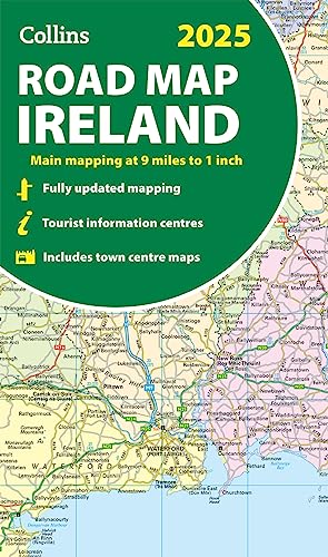
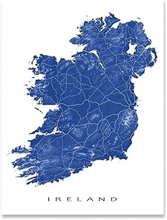
Full-colour map of Ireland at 9 miles to 1 inch (1:570,240), with clear, detailed road network and counties and new administrative areas shown in colour. This double-sided map covers the whole of Ireland, and is ideal for reference or route planning.
This map of Ireland shows the road network in detail. It is ideal for business users, with colouring of local council areas, but it is also perfect for tourists as a route planning map.
Main features include:
Product details
Publisher : Collins (14 Mar. 2024)
Language : English
Map : 2 pages
ISBN-10 : 0008653003
ISBN-13 : 978-0008653002
Dimensions : 12.7 x 1.52 x 22.23 cm
Best Sellers Rank: 6,249 in Books (See Top 100 in Books)
14 in Road Travel
18 in Routes & Ways Travel
36 in Historical Atlases & Maps
Customer reviews: 4.5
17 ratings
Amazon Price History
This is our record of Amazon price changes for 2025 Collins Road Map of Ireland: Folded map (Collins Road Atlas) (0008653003) since we began monitoring it.
| Price Type | Lowest Ever | Highest Ever | Current + | Average |
|---|---|---|---|---|
| Amazon | (Jun 30, 2026) | (Jun 30, 2026) | 0,00 € (Jun 30, 2026) |
0,00 €
Amazon Price
Jun 30, 2026 07:15 PM
Your Amazon Price Watches
We'll notify you when the price drops to your desired price.
Watch Price


Watch Price
Watch Price


Watch Price


Watch Price
Watch Price

Watch Price
Watch Price

Watch Price

Watch Price
Great Britain Road Atlas 2025 Hardback (AA Road Atlas) (AA Road Atlas Britain) (AA UK Atlas Britain)
Watch Price
Watch Price
![2024 Collins Road Map of Ireland: Folded Road Map [New Edition]](https://m.media-amazon.com/images/I/81LJLAvSERL._SL500_.jpg)


Watch Price
