Watch Price
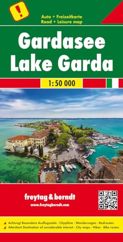
Lago di Garda 1:50.000: AK 0635 (Auto karte)
This detailed road map of Lake Garda is very suitable for planning and traveling around the country.
The road network is well represented, both the main roads, provincial and local roads. Road numbers are also clearly stated. Distances between places are marked on the map in kilometers, and gas stations are also marked in important places.
Shadow shows the relief and sometimes some points with the actual height. Province borders, national parks and reserves are easy to find. Symbols indicate the location of tourist sites, monuments, historically important places and viewpoints. In certain places you can find hotels and campsites, airports, train connections and ports.
Detalles del producto
Editorial : Freytag & Berndt; N.º 1 edición (1 enero 2008)
Idioma : Inglés
Mapa : 1 páginas
ISBN-10 : 3707917436
ISBN-13 : 978-3707917437
Peso del producto : 194 g
Dimensiones : 12.98 x 0.76 x 25.45 cm
Clasificación en los más vendidos de Amazon: nº744 en Mapas y atlas
nº16.790 en Hogar, manualidades y estilos de vida (Libros)
nº38.681 en Libros en inglés
Opiniones de los clientes: 4,4
31 valoraciones
Amazon Price History
This is our record of Amazon price changes for Lago di Garda 1:50.000: AK 0635 (Auto karte) (3707917436) since we began monitoring it.
| Price Type | Lowest Ever | Highest Ever | Current + | Average |
|---|---|---|---|---|
| Amazon | (Jun 14, 2026) | (Jun 14, 2026) | 0,00 € (Jun 14, 2026) |
0,00 €
Amazon Price
Jun 14, 2026 06:17 AM
Your Amazon Price Watches
We'll notify you when the price drops to your desired price.
Watch Price


Watch Price


Watch Price


Watch Price

![Dolomites Road Panoramic Map 1 : 200 000: Panoramakarte und Strassenkarte [Lingua inglese]: Lago di Garda - Venezia. Panoramakarte und Strassenkarte](https://m.media-amazon.com/images/I/51CSuVy6OSL.jpg)