Watch Price
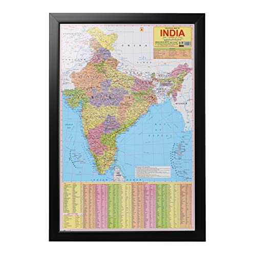
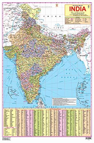
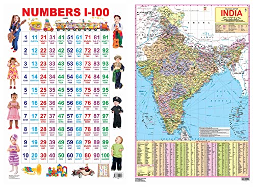
India Political Laminated & Framed Geography Studies(Latest Jammu & Kashmir Boundary) Framed Wall Map English Language Size (55 x80 cm)
Latest Map of India political with new Jammu and kashmir map approved by survey of india. Printed on high quality paper , laminated with polyster film , Framed for High Durablity, Strengh & long Life. Hanging Hook on back side for easy Installation on wall or doors. Ideal For Students , Schools , Offices..
Product details
ASIN : B08J7TLZJT
Publisher : Naqsha (1 January 2020)
Language : English
Item Weight : 50 g
Dimensions : 80 x 55 x 1 cm
Net Quantity : 1.00 Count
Generic Name : Wall Map
Best Sellers Rank: #264,232 in Books (See Top 100 in Books)
#507 in Maps & Atlases
Customer Reviews: 2.3
6 ratings
ASIN : B08J7TLZJT
Publisher : Naqsha (1 January 2020)
Language : English
Item Weight : 50 g
Dimensions : 80 x 55 x 1 cm
Net Quantity : 1.00 Count
Generic Name : Wall Map
Best Sellers Rank: #264,232 in Books (See Top 100 in Books)
#507 in Maps & Atlases
Customer Reviews: 2.3
6 ratings
Amazon Price History
This is our record of Amazon price changes for India Political Laminated & Framed Geography Studies(Latest Jammu & Kashmir Boundary) Framed Wall Map English Language Size (55 x80 cm) (B08J7TLZJT) since we began monitoring it.
| Price Type | Lowest Ever | Highest Ever | Current + | Average |
|---|---|---|---|---|
| Amazon | (Jul 01, 2026) | (Jul 01, 2026) | 0,00 € (Jul 01, 2026) |
0,00 €
Amazon Price
Jul 01, 2026 12:06 AM
Your Amazon Price Watches
We'll notify you when the price drops to your desired price.
Watch Price


Watch Price


Watch Price