Watch Price
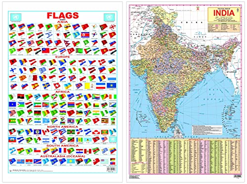
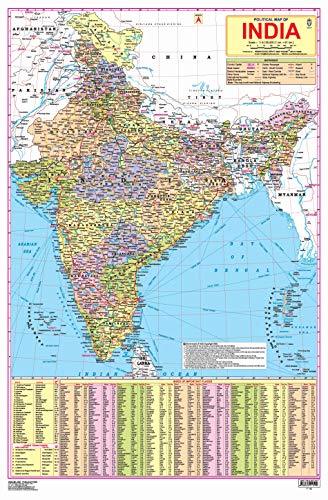
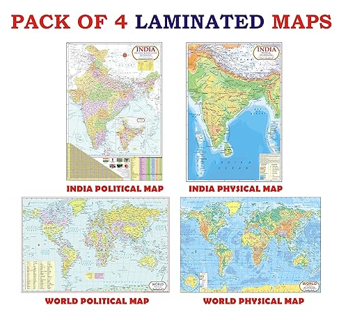
India Map (Laminated Both Sides ) - With New Union Territories of Jammu & Kashmir and Ladakh & Flag Chart Educational Wall Chart - Both Side Hard Laminated (Size 48 x 73 cm)
India Map (Laminated Both Sides ) - With New Union Territories of Jammu & Kashmir and Ladakh
India, a country in South Asia is the seventh-largest country in the world. Covering both physical and political features of the country this map shows states, UTs, and their capitals. It is a perfect wall chart for educational use, competitive exams, classrooms, teachers, and students.
• Ideal for ages 5-16
• Highly detailed
• Up-to-date
• Both side laminated
• Perfect size 48 cm (H) x 73 cm (W)
• Carton packing
• Outstanding quality
Ideal for schools, homes, offices, or any learning environment with all cartographic updates, this map is makes learning fun. It will help young geographers able to understand the symbols that show features such as rivers, roads, cities, or mountains and also know distances so that one knows how far away one thing is from another.
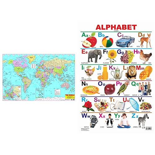
Flag Chart Educational Wall Chart - Both Side Hard Laminated (Size 48 x 73 cm)
Colourful visual learning tool, ideal for use at home and in schools, ‘Flag Chart’ includes flags of all the countries of the world. Encouraging young learners, this informative chart is a quick reference to familiarise them with names and flags of different countries.
• Ideal for ages 6-8
• Great complement to help children familiarise themselves with countries of the world
• Colourful presentation
• Both side laminated
• Perfect size 48 cm (H) x 73 cm (W)
• Outstanding quality
Ideal for schools, homes, offices, or any learning environment, this chart is perfect for students, globetrotters, and geography learners.
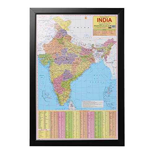
India, a country in South Asia is the seventh-largest country in the world. Covering both physical and political features of the country this map shows states, UTs, and their capitals. It is a perfect wall chart for educational use, competitive exams, classrooms, teachers, and students.
• Ideal for ages 5-16
• Highly detailed
• Up-to-date
• Both side laminated
• Perfect size 48 cm (H) x 73 cm (W)
• Carton packing
• Outstanding quality
Ideal for schools, homes, offices, or any learning environment with all cartographic updates, this map is makes learning fun. It will help young geographers able to understand the symbols that show features such as rivers, roads, cities, or mountains and also know distances so that one knows how far away one thing is from another.
Flag Chart Educational Wall Chart - Both Side Hard Laminated (Size 48 x 73 cm)
Colourful visual learning tool, ideal for use at home and in schools, ‘Flag Chart’ includes flags of all the countries of the world. Encouraging young learners, this informative chart is a quick reference to familiarise them with names and flags of different countries.
• Ideal for ages 6-8
• Great complement to help children familiarise themselves with countries of the world
• Colourful presentation
• Both side laminated
• Perfect size 48 cm (H) x 73 cm (W)
• Outstanding quality
Ideal for schools, homes, offices, or any learning environment, this chart is perfect for students, globetrotters, and geography learners.
Product details
ASIN : B0BLVWHLX3
ASIN : B0BLVWHLX3
Amazon Price History
This is our record of Amazon price changes for India Map (Laminated Both Sides ) - With New Union Territories of Jammu & Kashmir and Ladakh & Flag Chart Educational Wall Chart - Both Side Hard Laminated (Size 48 x 73 cm) (B0BLVWHLX3) since we began monitoring it.
| Price Type | Lowest Ever | Highest Ever | Current + | Average |
|---|---|---|---|---|
| Amazon | (Jul 06, 2026) | (Jul 06, 2026) | 0,00 € (Jul 06, 2026) |
0,00 €
Amazon Price
Jul 06, 2026 05:39 AM
Your Amazon Price Watches
We'll notify you when the price drops to your desired price.
Watch Price


Watch Price


Watch Price


Watch Price

Watch Price